
INTRODUCTION
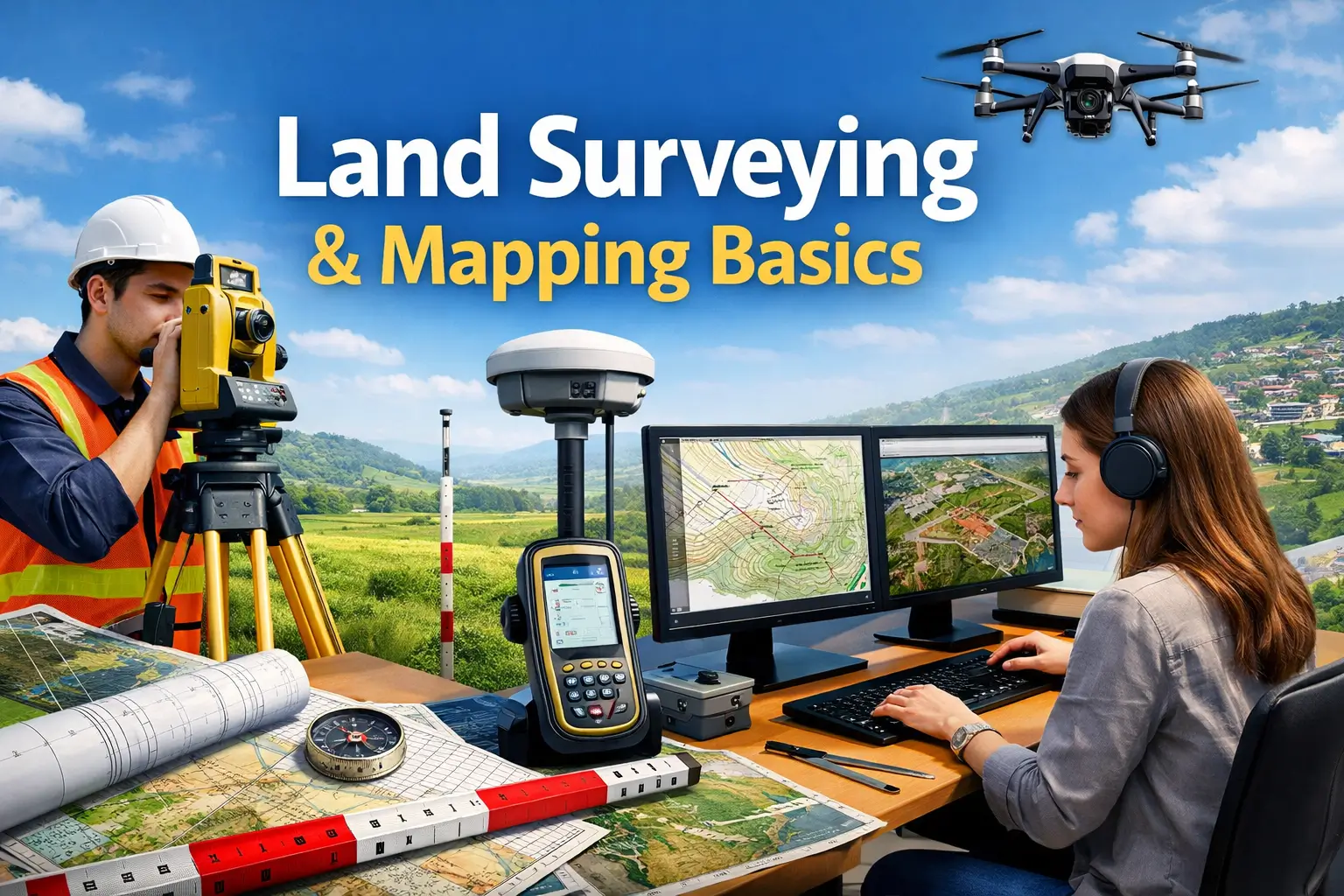
The Land Surveying & Mapping Basics Course is a structured beginner-level technical training program designed to help learners understand how land measurement and mapping work in real-world applications. Land surveying is a critical process used in civil engineering, construction, and infrastructure development to determine accurate positions and boundaries of land.
This course focuses on building foundational surveying skills for beginners.
WHAT IS LAND SURVEYING?
Land surveying is the process of measuring and mapping land areas.
Additionally, it helps define boundaries and spatial locations.
It is widely used in construction and engineering projects.
COURSE OVERVIEW
This course provides a step-by-step understanding of surveying techniques.
Learners will explore measurement tools and mapping methods.
Moreover, the course explains field data collection processes.
As a result, learners gain practical surveying knowledge.
IMPORTANCE OF LAND SURVEYING
Land surveying is essential for construction and development projects.
Moreover, it ensures accurate land use planning.
Consequently, it prevents legal and structural issues.
This course helps learners understand its importance in engineering.
SURVEYING TOOLS AND EQUIPMENT
Surveying requires specialized tools.
This section explains GPS devices, measuring tapes, levels, and theodolites.
Additionally, it improves field accuracy and efficiency.
MEASUREMENT TECHNIQUES
Accurate measurement is key to surveying.
This section explains distance, angle, and elevation measurement.
Moreover, it ensures correct mapping results.
LEVELING AND ELEVATION
Leveling helps determine height differences.
This section explains basic leveling methods and tools.
Additionally, it supports construction planning.
COORDINATE SYSTEMS
Coordinate systems help locate positions on land.
This section explains latitude, longitude, and grid systems.
Moreover, it improves mapping accuracy.
MAPPING AND DATA REPRESENTATION
Mapping converts survey data into visual formats.
This section explains how to create maps from collected data.
Additionally, it supports engineering projects.
REAL-LIFE APPLICATIONS
Land surveying is used in many industries.
This section explains applications in construction, road building, land records, and urban planning.
Moreover, it improves infrastructure development.
SKILLS YOU WILL GAIN
After completing this course, learners will develop:
Land surveying skills
Measurement techniques
Mapping knowledge
GPS usage skills
Coordinate system understanding
Field data collection
Construction planning basics
Technical drawing skills
Problem-solving skills
Engineering support skills
BENEFITS OF THE COURSE
The Land Surveying & Mapping Basics Course helps learners build strong technical and field skills. Additionally, it improves accuracy and analytical thinking.
Furthermore, surveying skills are highly valued in engineering and construction industries.
Benefits include:
Better technical knowledge
Improved job opportunities
Construction industry readiness
Accurate measurement skills
High-demand technical skills
Career growth in engineering
Fieldwork experience readiness
Infrastructure planning knowledge
WHO SHOULD ENROLL
This course is suitable for:
Civil engineering students
Surveying trainees
Construction workers
Urban planning learners
Technicians
Government job aspirants
Infrastructure professionals
Geography students
Architecture learners
Anyone interested in surveying
CAREER OPPORTUNITIES
After completing this course, learners may pursue roles such as:
Land Surveyor Assistant
Survey Technician Trainee
Civil Engineering Assistant
Mapping Technician
Construction Site Assistant
GIS-Survey Support Staff
Field Measurement Assistant
Infrastructure Survey Helper
Road Planning Assistant
Survey Data Operator
CERTIFICATION DETAILS
Upon successful completion of the Land Surveying & Mapping Basics Course, learners receive a certification recognizing their skills in land measurement, surveying techniques, and mapping fundamentals.
CONCLUSION
The Land Surveying & Mapping Basics Course provides a strong foundation in land measurement, mapping techniques, and surveying tools. It helps learners build practical skills for careers in civil engineering and infrastructure development.
Therefore, mastering land surveying opens valuable opportunities in construction, urban planning, and engineering industries.
FAQ SECTION
1. What is Land Surveying & Mapping Basics Course?
It is a beginner-level course that teaches land measurement and mapping.
2. Who should take this course?
This course is suitable for civil engineering students and technicians.
3. Do I need experience?
No, it is beginner-friendly.
4. What will I learn in this course?
You will learn surveying tools, measurement, and mapping.
5. Is this useful for jobs?
Yes, surveying skills are in demand.
6. Will I learn GPS usage?
Yes, basic GPS and measurement tools are included.
7. Is mapping included?
Yes, map creation is covered.
8. Will I get a certificate?
Yes, a completion certificate is provided.
9. Is this useful for construction jobs?
Yes, it supports civil engineering roles.
10. Is this useful for career growth?
Yes, it helps in engineering and infrastructure careers.



Reviews
There are no reviews yet.