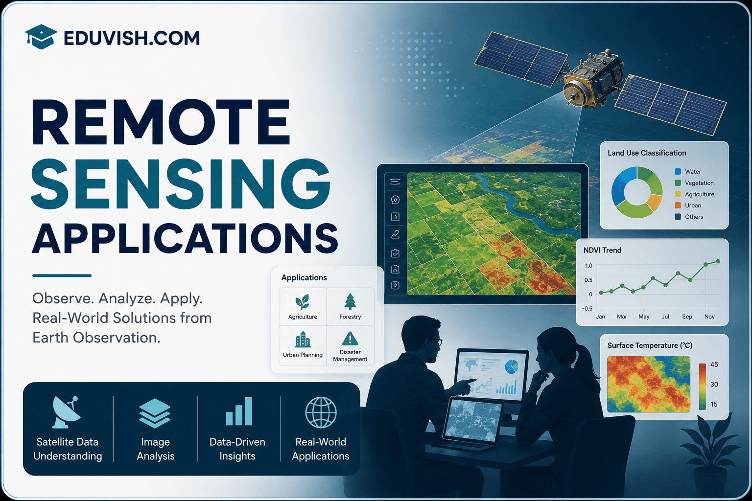
Remote Sensing Applications is a specialized course designed to introduce learners to the science and technology of acquiring information about Earth’s surface using satellite and aerial sensors. This program covers the fundamentals of remote sensing, image interpretation, data processing, and its wide-ranging applications in agriculture, forestry, urban planning, disaster management, and environmental monitoring.
Students will gain insights into electromagnetic spectrum principles, sensor types, GIS integration, and image classification techniques. The course emphasizes practical applications, preparing learners to analyze satellite imagery, monitor natural resources, and support decision-making in diverse industries.
By the end of this course, participants will be able to:
- Understand the fundamentals of remote sensing and electromagnetic radiation.
- Explore different types of sensors and platforms (satellite, UAV, aerial).
- Interpret and process remote sensing imagery using GIS tools.
- Apply image classification and enhancement techniques.
- Use remote sensing for agriculture, forestry, and water resource management.
- Evaluate applications in urban planning, disaster response, and climate studies.
- Contribute to sustainable development through geospatial technologies.
This course is ideal for students, researchers, environmentalists, and professionals in agriculture, geography, and urban development. With case studies, lab exercises, and industry-focused training, you’ll gain the confidence to apply remote sensing technologies in real-world scenarios.
FAQ SECTION
1. What is remote sensing?
Remote sensing is the process of collecting information about Earth’s surface using satellites, aircraft, drones, and sensors without direct physical contact.
2. Who should enroll in this course?
Students, GIS professionals, environmental scientists, agricultural experts, urban planners, researchers, and engineers can benefit from this course.
3. What skills will I learn?
You will learn satellite imagery analysis, GIS integration, spatial data interpretation, environmental monitoring, and mapping techniques.
4. Do I need prior GIS knowledge?
No, the course is designed for beginners and gradually introduces GIS and remote sensing concepts.
5. How is remote sensing used in agriculture?
Remote sensing supports crop monitoring, irrigation planning, soil assessment, and yield prediction.
6. Does the course include practical projects?
Yes, learners work on real-world case studies and practical data analysis exercises.
7. Is certification provided?
Yes, participants receive a certificate upon successful completion of the course.
8. What industries use remote sensing?
Agriculture, environmental management, urban planning, mining, forestry, disaster management, and government agencies widely use remote sensing technologies.
9. Can remote sensing help in disaster management?
Yes, it is extensively used for monitoring floods, droughts, wildfires, and other natural disasters.
10. What career opportunities are available after completing this course?
Career options include GIS Analyst, Remote Sensing Specialist, Geospatial Analyst, Environmental Consultant, Urban Planner, and Earth Observation Researcher.


Reviews
There are no reviews yet.